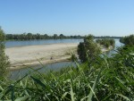
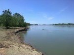
The River Po
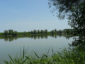
The River Po crosses northern Italy for around 650 km, passing by Ferrara on its way to the Adriatic.
History of the River
The main branch of the River Po, Italy’s longest river, flows north of the city of Ferrara, over 650 kilometres of water connecting the Alps to the Adriatic Sea.
In the past, when its path flowed further to the south, the river was key in the birth of Ferrara: the first clusters of habitations developed at the fork between two deltaic branches, the Po of Volano and the Po of Primaro, even before 1000 C.E. The two branches still exist, but have almost completely lost their ancient importance to commercial traffic.
The main path of the river moved to its current position following the river breaking its banks in 1150, due to artificial corrective work and due to the major earthquake of 1570.
The River and Surrounding Area
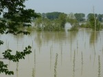
The River Po is an important ecological corridor. On the Veneto side, the floodplain is part of IT 3270017, while the section which flows through the Ferrara area is rich in habitats and species of conservational interest, meaning that the entire floodplain has been included in the large European ecological network Natura 2000, which aims to protect biodiversity at the EC level, under code SIC-ZPS IT4060016.
The Destra Po cycle track, which runs between Bondeno and Mesola virtually without interruption, runs on the riverbank.
Around Ferrara, the Natura 2000 site includes various places of particular naturalistic interest: from east to west are the Isola Bianca, or white island, with a large veteran white poplar; the Po River Park; the Vallelunga floodplain; and the Bosco Nuovo di Ravalle and Bosco di Porporana woodland areas. The status of ecological corridor is also granted to two ancient deltaic branches which were behind the origins of Ferrara: the Po of Primaro is also included in a Natura 2000 site (ZPS IT4060017), while the Po of Volano, the only river in the region which crosses the plain entirely in the east to west direction, has been designated a protected area as a corridor in the Emilia-Romagna ecological network.
Note
SCI (site of community importance) Areas.
Special Protection Areas (SPA).
Bibliography
- Bondesan Marco, L’area deltizia padana: caratteri geografici e geomorfologici, in Bondesan Marco, Il Parco del delta del Po: studi ed immagini, 1, Spazio Libri Ed, Ferrara 1990, pp. 9-48, 21 ff, 2 tabb.
- Burrato Pierfrancesco, Ciucci Francesca, Valensise Gianluca , An inventory of river anomalies in the Po Plain, Northern Italy: evidence for active blind thrust faulting ANNALS OF GEOPHYSICS, Vol. 46, N. 5 2003 Vai al testo digitalizzato
- Regione Emilia-Romagna, Programma per il sistema regionale delle aree protette e dei siti Natura 2000. Elaborato tecnico n. 3 - Le aree di collegamento ecologico di livello regionale. 2009
Sitography
- http://ambiente.regione.emilia-romagna.it/parchi-natura2000/rete-natura-2000/siti/siti-per-provincia/ferrara
- http://www.bonificadeltadelpo.it/02-header-menu/la-storia-del-territorio/la-formazione-del-delta-del-po/
- http://www.bonificaferrara.it/index.php/sitl1/morfologia-del-territorio/63-evoluzione-del-territorio-e-della-fascia-costiera
- http://ambiente.regione.emilia-romagna.it/parchi-natura2000/aree-protette/caratteristiche-sistema/programma-regionale/3_Aree_di_collegamento_ecologico.pdf/at_download/file/3_Aree_di_collegamento_ecologico.pdf
- http://ingvterremoti.wordpress.com/2014/11/21/la-geologia-dei-terremoti-faglie-sismogenetiche-cieche-in-pianura-padana/
Fototeca
Related places
Compiling entity
- Museo Civico di Storia Naturale di Ferrara

